Om siden
Opret bruger / Log ind
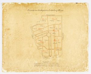
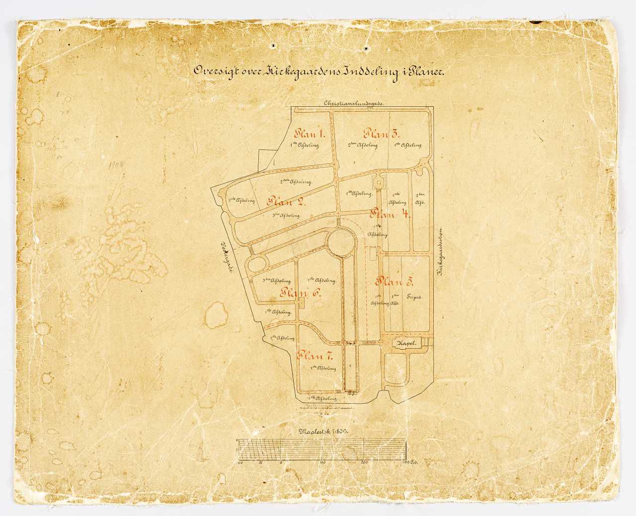
Plan over Nyborg Kirkegård, 1800-tallets slutning. Nyborg Kirkegård, Nyborg
Download
Del
Beskrivelse
1:1500 I Nyborg Kirkegårdskontor DK Kirker, Svendborg 13, 1279
Tid
Datering
Tuesday, November 4, 2014
Senest opdateret
Monday, May 30, 2022
Placering
Koordinater
55.31462, 10.79323
Adresse
Kronprinsensgade 34
By
Nyborg
Postnummer
5800
Emneord
Nationalmuseet
Emne
Kirker
Kirkebygningen
Tegningsmateriale
Kirkegårde
Kommentarer
Detaljer
Fotograf
-
Licens
CC-BY-SA
Kilde
Nationalmuseet, Danmark
Fil-ID
DMR-210457
Filnavn
dmr_260814_069..tif
Original filstørrelse
47 MB
Original opløsning
3912x3175 pixels
OK
Download JPEG
3912x3175 pixels -
Licens:
CC-BY-SA
Download original (TIFF Image)
3912x3175 pixels -
Licens:
CC-BY-SA
-
47 MB
https://samlinger.natmus.dk/dmr/asset/210457
Kopiér link
Fast bredde og højde
x
pixels
Fast bredde
x
pixels
Fast højde
x
pixels
100% bredde
behold billedformat
100% højde
behold billedformat
Kopiér nedenstående HTML
Kopiér HTML-kode
Plan over Nyborg Kirkegård, 1800-tallets slutning. Nyborg Kirkegård, Nyborg
1:1500 I Nyborg Kirkegårdskontor DK Kirker, Svendborg 13, 1279