Om siden
Opret bruger / Log ind
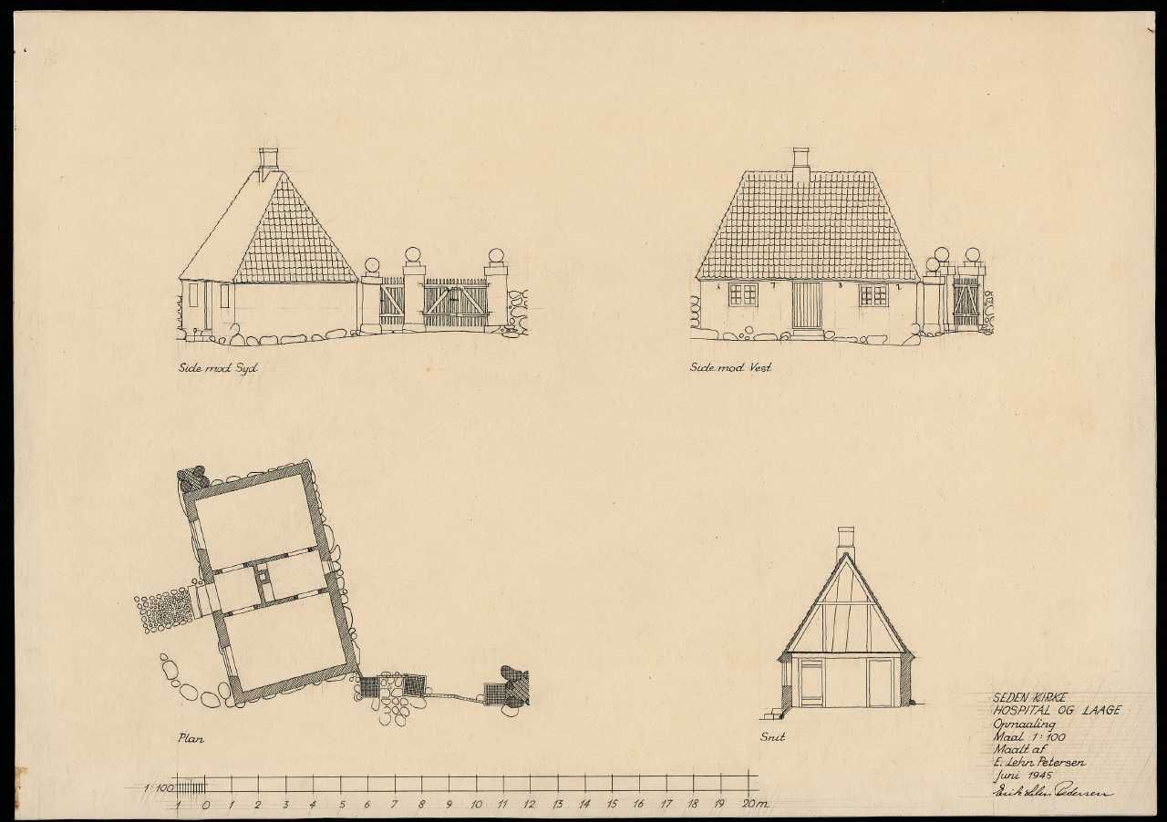
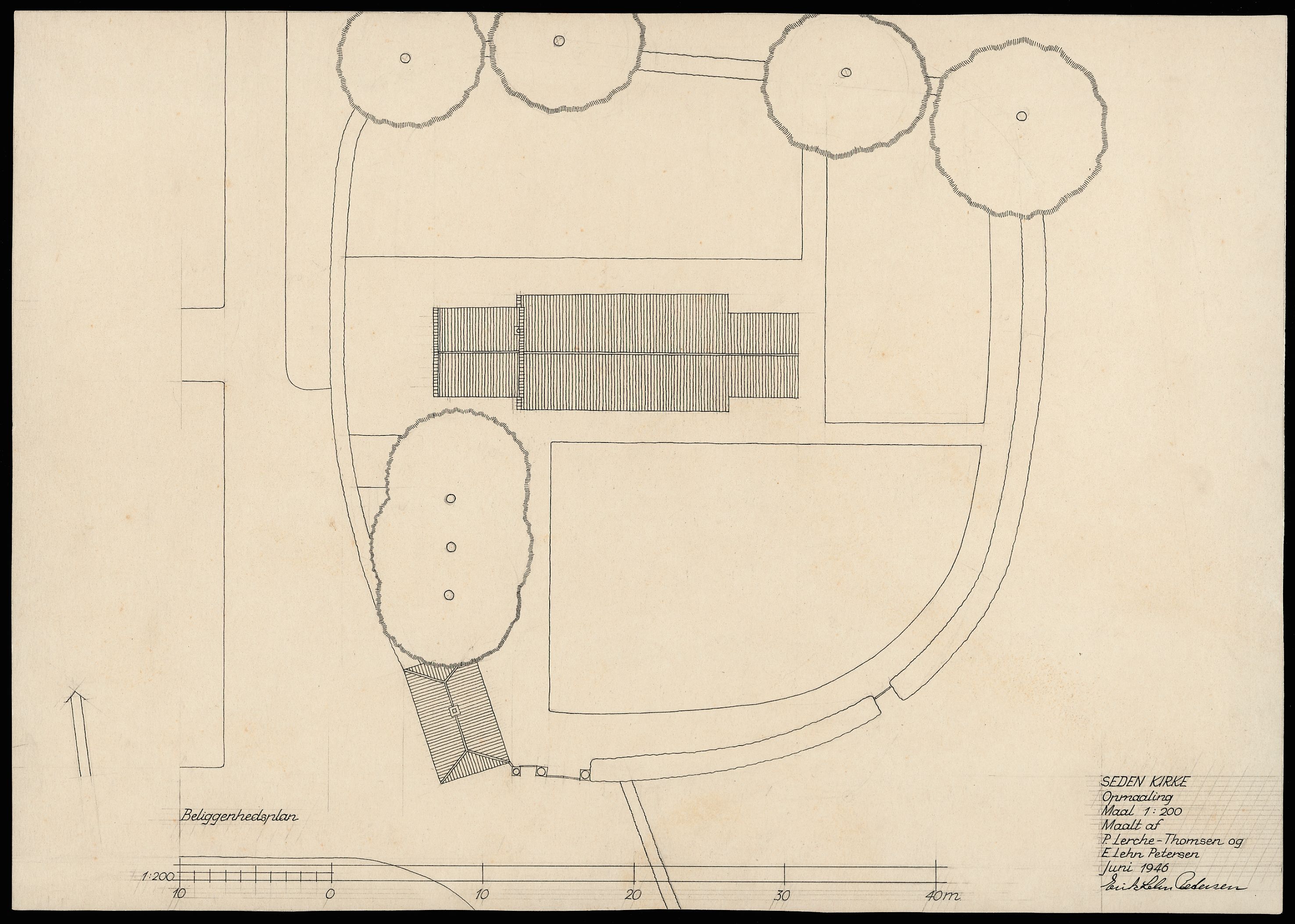
Plan, opstalter og snit af Seden Kirkes tidl. hospital fra 1732.
Download
Del
Beskrivelse
Målt af P. Lerche-Thomsen og Erik Lehn Petersen, tegnet af sidstnævnte. DK Odense (hft.33-34), 3450
Tid
Datering
Tuesday, September 29, 2015
Senest opdateret
Sunday, April 24, 2022
Placering
Koordinater
55.42878, 10.43325
Adresse
Mindelundsvej 47, Seden
By
Odense NØ
Postnummer
5240
Emneord
Nationalmuseet
Emne
Kirker
Kirkebygningen
Tegningsmateriale
Opstalter
Planer
Snit
Lokalitet
Odense amt
Åsum herred
Seden
Kommentarer
Detaljer
Fotograf
Arnold Mikkelsen
Licens
CC-BY-SA
Kilde
Nationalmuseet - DK
Fil-ID
DMR-178609
Filnavn
1547459_426.tif
Original filstørrelse
25 MB
Original opløsning
2962x2087 pixels
Licens
CC-BY-SA
Kilde
Nationalmuseet - DK
Fil-ID
DMR-178607
Filnavn
1547459_424.tif
Original filstørrelse
25 MB
Original opløsning
2952x2107 pixels
OK
Download JPEG
2962x2087 pixels -
Licens:
CC-BY-SA
Download original (TIFF Image)
2962x2087 pixels -
Licens:
CC-BY-SA
-
25 MB
Download JPEG
2952x2107 pixels -
Licens:
CC-BY-SA
Download original (TIFF Image)
2952x2107 pixels -
Licens:
CC-BY-SA
-
25 MB
https://samlinger.natmus.dk/dmr/asset/178609
Kopiér link
Fast bredde og højde
x
pixels
Fast bredde
x
pixels
Fast højde
x
pixels
100% bredde
behold billedformat
100% højde
behold billedformat
Kopiér nedenstående HTML
Kopiér HTML-kode
https://samlinger.natmus.dk/dmr/asset/178607
Kopiér link
Fast bredde og højde
x
pixels
Fast bredde
x
pixels
Fast højde
x
pixels
100% bredde
behold billedformat
100% højde
behold billedformat
Kopiér nedenstående HTML
Kopiér HTML-kode
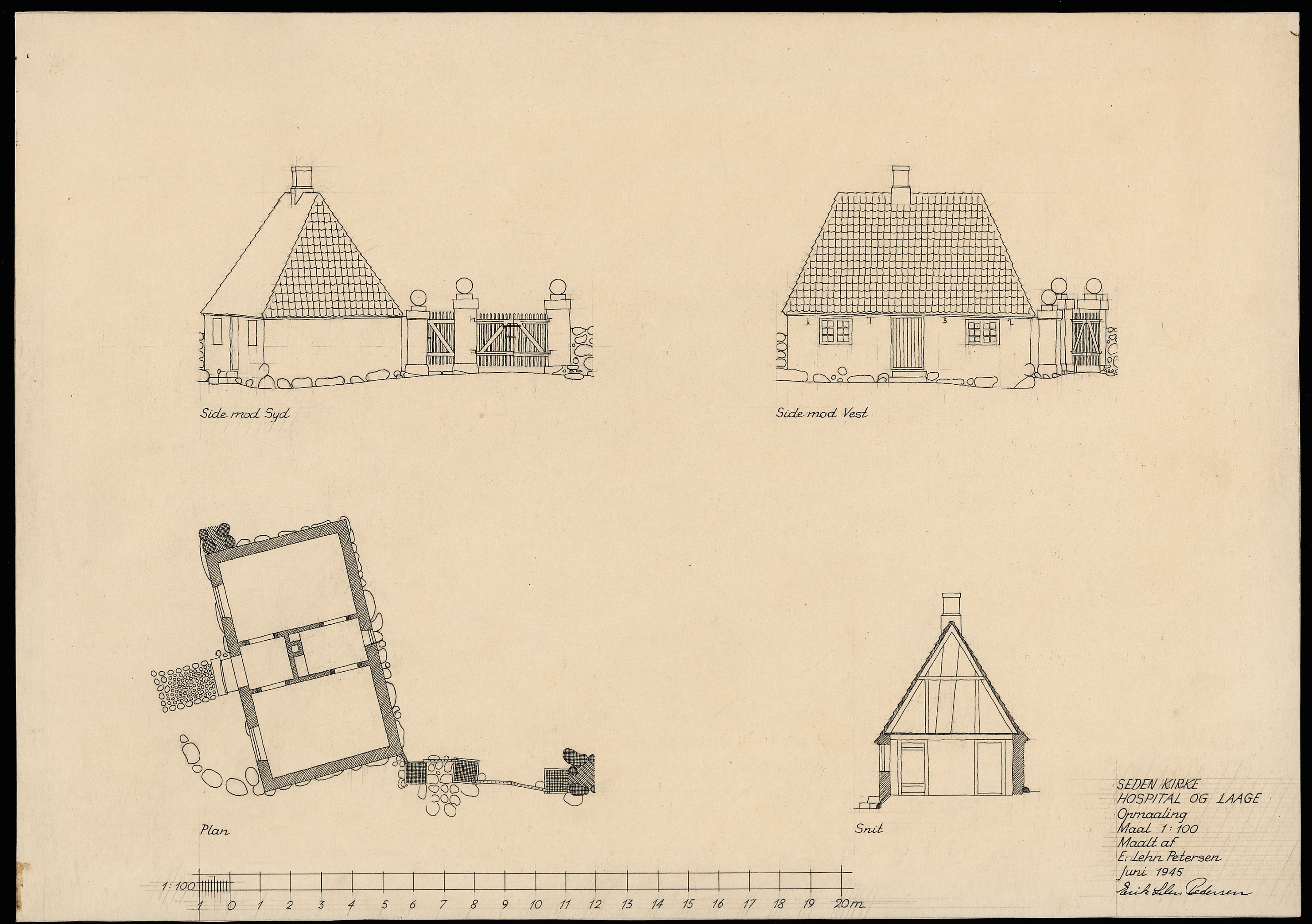
Plan, opstalter og snit af Seden Kirkes tidl. hospital fra 1732.
Målt af P. Lerche-Thomsen og Erik Lehn Petersen, tegnet af sidstnævnte. DK Odense (hft.33-34), 3450